
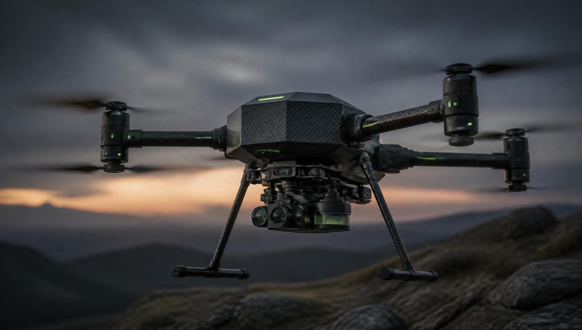
Intelligent terrain. Safer futures.
Advanced multi-sensor aerial mapping and AI-assisted terrain intelligence for hazardous environments.
The MINE-SCAN family
A modular technology ecosystem for hazardous terrain intelligence.
MS-01 SCOUT
Compact aerial survey platform
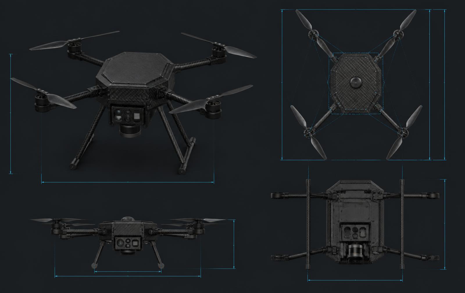
A compact multi-sensor aerial platform designed for rapid terrain surveying, mapping, and research, built around a quick-release modular payload bay.
- Compact multirotor airframe with four foldable arms
- Quick-release underside modular payload bay
- Downward-facing LiDAR and RGB mapping camera
- RTK/GNSS positioning module
MINE-SCAN is an active development programme. Prototype and concept platforms shown are not certified or commercially available systems, and all AI-assisted outputs require professional verification.
The first MINE-SCAN prototype
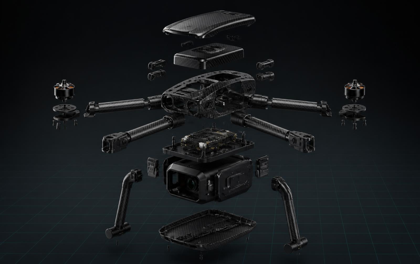
A serious engineering prototype: compact multirotor airframe, central electronics body, four modular arms and propulsion units, lightweight landing gear, and an underside modular payload bay carrying downward LiDAR, an RGB mapping camera, optional sensor pods, and an RTK/GNSS positioning module.
Modular sensor intelligence
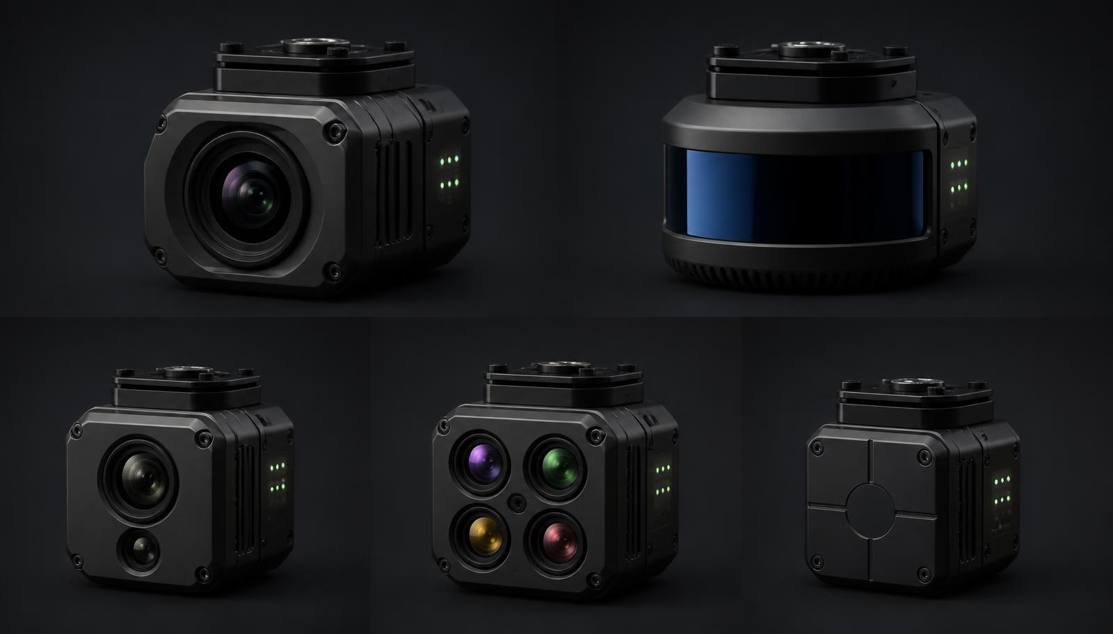
One universal payload bay, five interchangeable pods. Mission profiles are configured by swapping sensing modules rather than aircraft.
RGB Mapping Pod
High-resolution visual mapping, ortho-mosaics, and terrain documentation.
LiDAR Pod
3D terrain reconstruction, elevation mapping, vegetation analysis, and surface anomaly mapping.
Thermal Pod
Thermal imaging for environmental and terrain analysis in varied light conditions.
Multispectral Pod
Multi-band vegetation and soil analysis across the survey area.
Magnetometry Pod
Research-oriented magnetic anomaly mapping over surveyed ground.
- MS-01 Airframe
- Universal Payload Bay
- Interchangeable Sensor Pods
- Data Fusion
- AI-Assisted Analysis
- Geospatial Intelligence
The intelligence layer
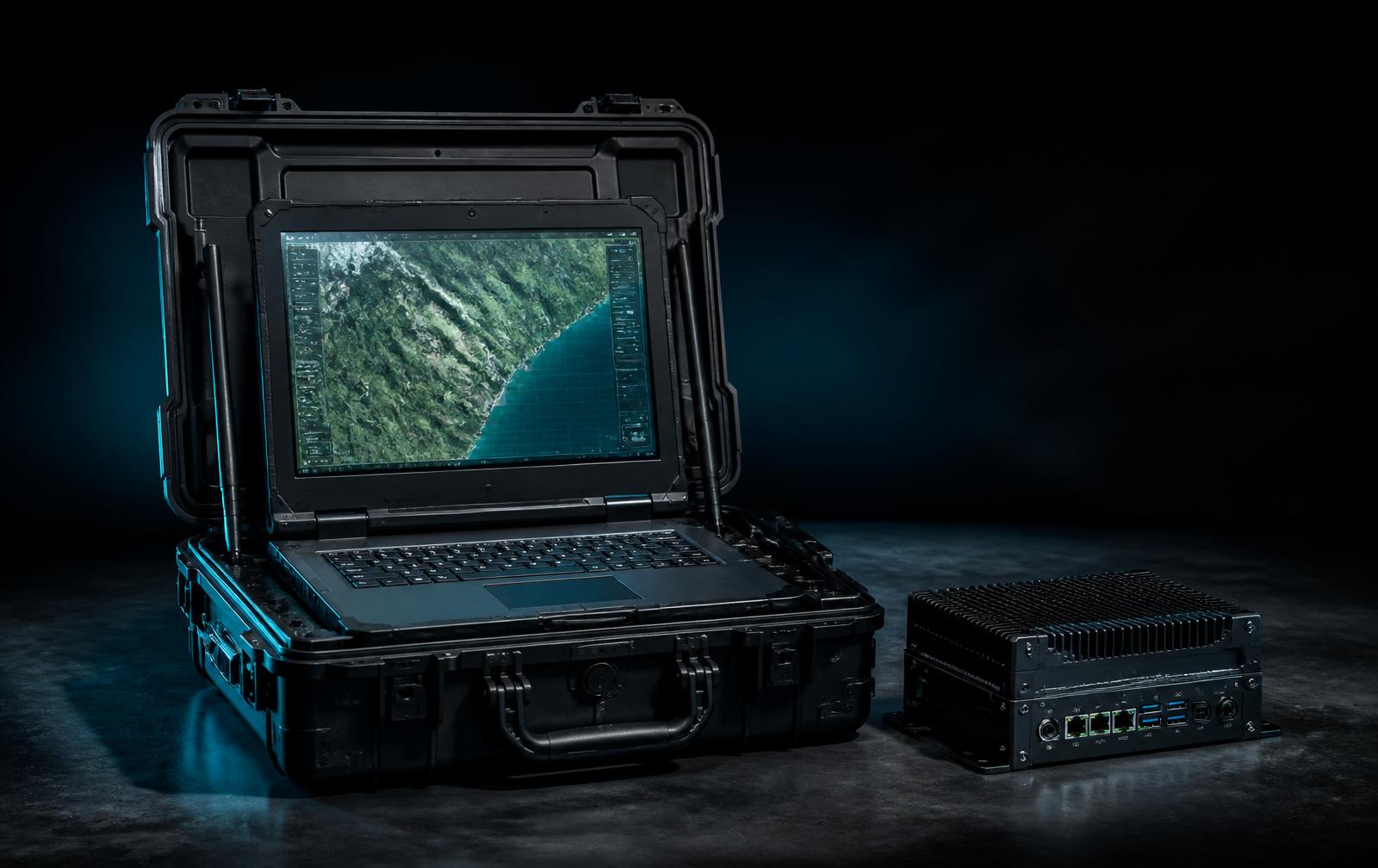
A supporting ground-control and data-analysis environment designed to manage survey missions, visualize geospatial data, combine sensor information, generate terrain maps, identify potential anomalies, and support professional review. MINE-SCAN Command is a component of the MINE-SCAN system, not a separate Flexiview Group product.
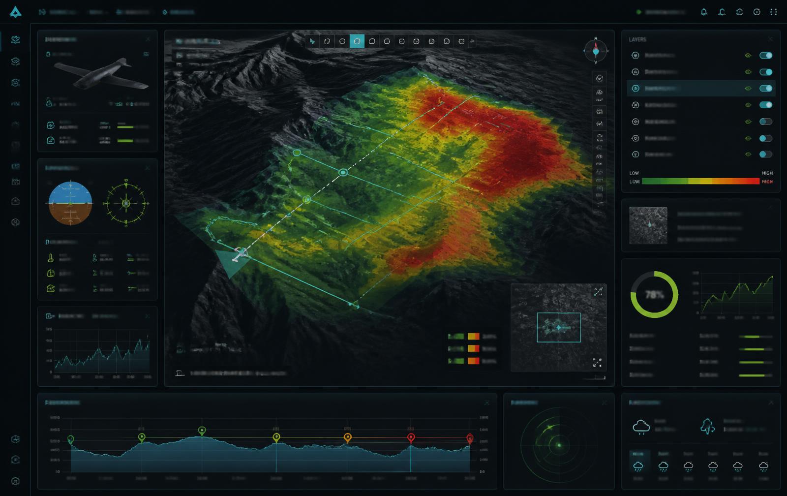
- Mission Map
- 3D Terrain
- LiDAR Visualization
- Sensor Layers
- Survey Path
- Potential Anomaly Map
- Risk Visualization
- Mission Reports
AI-assisted decision support. Outputs highlight potential anomalies only and do not confirm the presence or absence of mines or unexploded ordnance. All findings require professional verification.
From survey flight to verified insight
Every MINE-SCAN output travels the same path — and always ends with a qualified professional.
- 01
MS-01 / MS-02 / MS-03
Aerial survey platforms tasked across the target area.
- 02
Modular Sensor Pods
Interchangeable payloads selected per mission profile.
- 03
Data Collection
Time-aligned imagery, point clouds, and telemetry capture.
- 04
FLX-EDGE AI
Onboard compute pre-processes and filters survey data in flight.
- 05
Sensor Fusion
Heterogeneous sensor layers are correlated into one geospatial model.
- 06
3D Terrain Mapping
Elevation models, ortho-mosaics, and surface reconstruction.
- 07
AI-Assisted Analysis
Models highlight potential anomalies as decision support only.
- 08
MINE-SCAN Command
Mission management, visualization, and reporting environment.
- 09
Professional Human Verification
Qualified professionals review and verify every finding.
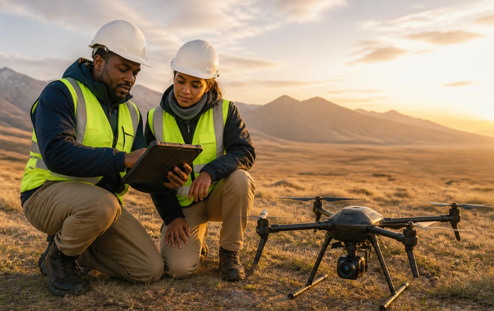
Where MINE-SCAN could support professionals
Areas under study. No claim of current deployment is made for any environment listed.
Humanitarian Mine Action
Survey support for humanitarian land-release programmes.
Hazardous Terrain Mapping
High-resolution mapping of terrain considered unsafe to enter.
Post-Conflict Land Assessment
Baseline geospatial assessment of affected land.
Disaster Response
Rapid terrain change mapping after natural events.
Search & Rescue
Wide-area aerial coverage supporting response teams.
Environmental Surveying
Vegetation, soil, and surface condition analysis.
Infrastructure Assessment
Condition and terrain surveys around linear infrastructure.
Remote Terrain Intelligence
Geospatial understanding of hard-to-reach environments.
MINE-SCAN development roadmap
An indicative development sequence. Phases are directional and do not represent guaranteed delivery dates.
Phase 01
Concept Architecture
System concept, sensor architecture, and mission profiles defined.
Phase 02
3D-Printed Prototype
MS-01 Scout airframe prototyping and mechanical validation.
Phase 03
Sensor Integration
Payload bay, LiDAR, RGB, and RTK/GNSS integration.
Phase 04
Controlled Testing
Supervised flight and data-capture testing in authorized areas.
Phase 05
AI-Assisted Mapping
Data fusion and anomaly-highlighting model development.
Phase 06
Pilot Program
Collaborative pilots with partners, subject to approvals.
Phase 07
Future Commercialization
Productization pathway following successful evaluation.
Documentation
MINE-SCAN product brief
- Product Overview
- MS-01 Scout
- Sensor Ecosystem
- AI-Assisted Mapping
- MINE-SCAN Command
- Applications
- Development Roadmap
- Contact Information
The MINE-SCAN product brief is issued on request to partners, humanitarian organizations, research institutions, and government bodies.
Request a technical brief
Datasheets, deployment documentation, and pricing are available on request for infrastructure, aviation, industrial, and public-safety operators.